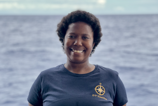
Memphis Washington’s Path to Creating a Gender-Diverse Environment in the Seafloor Mapping Space

This feature was written by NA166 Communications Lead Madison Dapcevich.
When Memphis Washington was a young child, their ambitions presented a world of opportunity – did they want to be a doctor? A writer, actor, or musician? How about a teacher? Their uptown New York City home offered a diverse experience in the arts, sciences, and politics from a young age.
“These experiences encouraged me to participate actively in both my own life and the world,” said Memphis. As Memphis grew, those dreams changed rapidly and continue to evolve as they learn more about the world and their place in it.
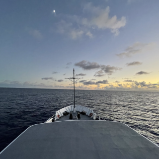
In 2024, Memphis is one of three Seafloor Mapping and Hydrography interns aboard E/V Nautilus participating in NA166, an expedition to map the areas surrounding Baker and Howland Islands. During this cruise, scientists mapped within the territorial waters of six countries as well as international waters, sailing across more than 4,400 miles of open ocean. This expedition will contribute data to Seabed2030 and help advance the ocean understanding of all nations.
“This largely entails cleaning bathymetric data in near-real time, deploying and processing data from an expendable bathythermograph, participating in ship-to-shore interactions, producing bathymetric and backscatter data products, and other miscellaneous scientific and social tasks associated with the program,” said Memphis.
This wasn’t Memphis’ first experience in the world of hydrography. Previously, Memphis held an internship as an Ocean Data Apprentice at the Lamont-Doherty Earth Observatory at Columbia University with Dr. Vicki Ferrini, where they focused on equitable efforts to map the world’s seabed under Seabed 2030. During this time, Memphis focused on equitable efforts for mapping the seafloor, which they say involves a “sense of fairness and justice concerning how mapping targets are prioritized.”
“Mapping the global ocean has to do with human survival as much as life below water and general scientific curiosity. Achieving an equitable prioritization schema requires consideration of a matrix of concerns that touch on the global economy, local data and material infrastructure, and vulnerability to climate change,” said Memphis.
“For nations which have high populations in climate change-vulnerable coastal communities with poor local infrastructure to support mapping initiatives, there is an urgency surrounding mapping that does not exist for nations with better resourced and less vulnerable populations.”
Bathymetric data like that collected aboard E/V Nautilus informs a plethora of critical environmental, economic, and sociocultural activities, including marine habitat management, which informs economically vital shipping and fishing industries; infrastructure like piers, ports, coastal defense systems, and industrial institutions; off-shore wind; and other critical infrastructure, all of which Memphis says can support autonomous and equitable economic activity.
“I want to borrow from disability justice activists the concept, ‘nothing about us without us,’ as a guiding principle of these equitable prioritization efforts. Mapping is a collaborative effort that must engage directly with the communities it serves,” said Memphis.
Memphis’ experience as a gender nonbinary person in the mapping community lends to this inclusive perspective. As mapping is a globally collaborative effort working across cultures, languages, nationalities, and genders, measures to include a greater understanding of gender and sexual preferences create a space to ask questions and receive research-based information for working in gender-diverse workplaces.
"As we try to “map the gaps” and reach a goal of 100% of the seafloor mapped, outreach and collaboration must robustly engage directly with communities who can articulate their urgent mapping needs and guide a more sensitive and responsive mapping effort."
“Such measures are small investments that can be made to more meaningfully connect across the diverse tapestry of people already in our mapping community,” they said.
As for their participation aboard Nautilus, Memphis adds their path to seafloor mapping “was a winding one.” Building from their Lamont-Doherty experience and growing perspective on how mapping data is shared and used, the at-sea acquisition experience was a major part of their understanding the international efforts to map the world’s ocean. Having now spent nearly a month at sea aboard E/V Nautilus, Memphis says the daily work environment offers a dynamic and real-time experience that widened their understanding of international mapping efforts.
For future interns interested in applying and participating in exploration endeavors aboard Nautilus, Memphis offers a simple piece of advice.
“I always suggest trying out a few different things to either eliminate or add things to your list of career pursuits; both are useful outcomes.”

Seafloor Mapping Offshore Howland and Baker Islands
Howland and Baker Islands lie just north of the equator, about 1,800 miles southwest of Hawaiʻi. The islands are low-lying, sandy coral islands ringed by narrow fringing reefs and surrounded by the deep ocean. The US exclusive economic zone around Howland and Baker represents one of the least explored regions under US jurisdiction.


