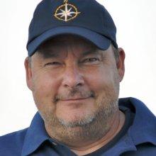
Mark DeRoche
Mark DeRoche has been going to sea for the last 31 years, the last 16 with Institute for Exploration and Ocean Exploration Trust. Mark is Deck Chief on the E/V Nautilus.
Mark DeRoche went to school for a couple years for wooden boat building, graduating in 1981. In about 1984-85 he went back to school for Marine Science, graduating with a Coast Guard licence. Mark is in charge of safety on the back deck, responsible for the safe launch and recovery of all over the side equipment. He has been going to sea for 27 years and has worked on a variety of ships mostly oceanographic. Mark graduated from Washington County Community College in 1981 with a degree in Boat Building. He went to Bangor Community College for two years 1981-1983. Then Southern Maine Comunity College for Marine Science, graduating in 1985 with a degree in Marine Science and a 3rd Mates Licence.
Mark has very happily worked as chief of deck operations for Dr. Ballard since 2000. Prior to that, he worked at Woods Hole Oceanographic Institution for 12 years in a variety of seagoing capacities, from Messman to 2nd Mate on WHOI's research vessel Atlantis II. When not on the E/V Nautilus, Mark makes his home in Maine.
"I knew in the 4th grade I wanted to go to sea. It wasn't until I was getting my degree in Marine Science that I narrowed it down to oceanographic ships and have been working on them ever since."
Expeditions
Mark participated in the following Ocean Exploration Trust expeditions:
2010
2011
- Internal Wave Motion of the Southern Black Sea
- Coastal Landscape of Datça Peninsula
- Hellenic Volcanic Arc and Cretan Basin
- Submarine Volcanoes of the Aeolian Arc and Tyrrhenian Sea
- Mazarron Escarpment and the Alboran Sea
- Search for Serpentization on Gorringe Bank
- Submarine Volcanism in the Straits of Sicily
- Eastern Mediterranean Sea
2012
2013
- Ecosystem Impacts of Oil and Gas Inputs to the Gulf (ECOGIG)
- Natural Hydrocarbon Detection Mapping
- Shipwreck 15577 - The Monterrey Wreck
- Natural Hydrocarbon Detection ROV/AUV
- Galveston to Cayman Transit
- Cayman Rise
- Greater Antilles
- Impact of Volcanic Eruptions on the Seafloor
- Kick’em Jenny & Trinidad Tar Seeps
2014
- Straits of Florida
- Dry Tortugas
- ECOGIG
- Exploring Unknown America
- Gulf Integrated Spill Research (GISR)
- Mesoamerican Reef
- Windward Passage Project
- Mapping Transit Montego Bay, Jamaica, to San Juan, Puerto Rico
- Anegada Passage & the British Virgin Islands' Seamounts
- Seafloor Mapping: British Virgin Islands to Grenada
- Kick 'em Jenny Submarine Volcano Project
2015
- ECOGIG
- Cold Methane Seeps in the Gulf of Mexico
- Gulf of Mexico Technology Exploration
- Panama Canal Crossing & Transit to the Galapagos
- Galapagos Rift Exploration
- Galapagos Rift
- Galapagos Platform
- Seamount Mapping
- California Borderlands: Our Unknown Backyard
- South/Central California Margin
- Ocean Networks Canada
2016
2017
- Seafloor Mapping the National Marine Sanctuaries
- Ocean Networks Canada
- Seafloor Mapping the US EEZ
- Channel Islands National Marine Sanctuary
- Central California Technology Testing
- Cordell Bank National Marine Sanctuary
- Quinault Canyon & Olympic Coast National Marine Sanctuary
- Heceta Bank
- Gulf of California
- Pescadero Basin
- Revillagigedo Archipelago
2018
- Southern California Mapping
- Cascadia Margin
- Cascadia Margin & Washington Mapping
- Northeast Pacific Seamounts
- Ocean Networks Canada
- Kamaʻehuakanaloa (formerly Lō`ihi Seamount)
- Papahānaumokuākea Marine National Monument
- Monterey Bay National Marine Sanctuary
- Submerged Shorelines of California Borderland
2019
2020
2021
- Santa Barbara Basin & West Coast EEZ Mapping
- Cascadia Margin Seep Exploration
- Ocean Networks Canada
- ROV Recovery at Endeavour
- OECI Technology Demonstration: Nereid Under Ice (NUI) Vehicle + Mesobot
- Luʻuaeaahikiikapapakū - Ancient Volcanoes in Papahānaumokuākea Marine National Monument
- Luʻuaeaahikiikekualonokai - Chautauqua Seamounts
