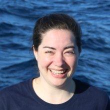
Beth Gonzalez
Tell us about your work / research. What kinds of things do you do?
I acquire, analyze, and evaluate geospatial data and sources to determine the quality of the data and suitability for inclusion on hardcopy and digital charting products in support of Maritime safety of navigation. I also verify accurate placement, positions, and attributes of various nautical and land features, which includes performing complex analysis and decision making regarding the depiction and attribution of features, and authoring of metadata. I work with many different types of data and use various geospatial software programs to process this data.
What sparked your initial interest in your career?
I love geography! When I was growing up, I used to play a game called GeoSafari and would repeat the games over and over until I knew where all of the countries or capitals were located. I also loved to stare at maps or read atlases and find all of the interesting things hidden in them. My curiosity about the world continued as I got older and I was able to go to college for geography, GIS, and remote sensing. Having a background in graphic design and photography also helped me transition to becoming a real-life cartographer.
Who influenced you or encouraged you the most?
My professors in college were very open and encouraged all students to ask questions and explore possibilities. I also admire a lot of photojournalists who travel all over the world to document cultures and events. A map or chart is only a snippet of time and the world is so dynamic. I try to keep this in mind when working on any project.
What element of your work / study do you think is the most fascinating?
The most fascinating thing about creating new maps or charts is all of the things that are named! Humans really like to put a name on just about anything, significant or not, and some of the names we come up with are very unique.
What other jobs led you to your current career?
I was an intern with the same agency I work for now, and before that, I worked at a credit union for a long time. You could say I took a roundabout way to become a cartographer, but I gained very relevant job skills in all my prior experiences. Going back to college to major in Geography is what set me on the path that got me to where I am now.
What are your degrees and certifications?
Bachelor of Science in Geographic Information Science and Technology - New Mexico State University 2014, GEOINT Professional Certification, Level 2, Cartography - NGA 2017
What are your hobbies?
Playing with my new puppy, hiking and visiting National Parks, knitting, and holiday baking. I also just recently got into playing board games.
What advice would you give to someone who wants to have a career like yours?
If you want to be a cartographer, geographer, or are just curious about different cultures around the world, find a college who offers classes in more than one area or "theme" of geography. You should strive to be well-rounded in all aspects of GIS, remote sensing, and cartography; not just focused on the technical or cultural aspects. Being able to manage data, but also understand the data and what it means is crucial to being a successful geographer now and in the future. I also suggest taking film/digital photography, graphic design, and computer coding classes to better understand imagery concepts, cartographic principles, and the underlying geoprocessing tools which are used every day in map and chart making. Be open-minded and use your creativity and passion to be successful in geography. You really can apply geographic concepts and principles to just about anything in any other field, so do not be afraid to combine passions into one exciting career.
Expeditions
Beth participated in the following Ocean Exploration Trust expeditions:
