Nā Hua ʻŌlelo no ka Huakaʻi Nautilus - Nautilus expedition terms in ʻŌlelo Hawaiʻi

OET aims to uplift and celebrate the vibrant resurgence of ʻŌlelo Hawaiʻi (the Hawaiian language).
We are grateful for the knowledge of kumu who have helped assemble this language list to develop a shared terminology for deep-sea expeditions as we learn more and share Papahānaumokuākea Marine National Monument with learners in Hawaiʻi, across the Pacific, and around the world.
This was created through the contributions of the Papahānaumokuākea Native Hawaiian Cultural Working Group facilitated by the Office of Hawaiian Affairs including Jacob Hauʻoli Lorenzo-Elarco, Kalamaʻehu Holden Takahashi, Hōkūokahalelani Pihana, Dr. Alyssa Anderson, Kanoelani Steward, and Kalani Quiocho.
Contributors’ note: There are likely several Hawaiian words or expressions to describe these things, and we have compiled this list as suggestions only.
Find these terms also in the education resource Nā Huaʻōlelo Huakaʻi ʻAumoana - Visual Vocabulary 'Ōlelo Hawaiʻi & English
Technical/Operational terms: Nā hua ʻōlelo ʻEnehana
- Exploration Vessel / research ship / ship - moku (E/V = moku noiʻi noelo)
- Ship name: E/V Nautilus
- Remotely Operated Vehicle (ROV) - Mokuluʻu kia auwaea
- ROV names: Hercules, Argus, Little Hercules, and Atalanta
- ROV sampling tools
- Suction/slurp sample - omo ʻāpana
- Grab sample - lālau i ka mea
- Push core/sediment core - hāpana pōhaku
- Niskin/water sample - hāpana wai
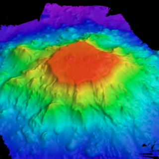
- Seafloor (or multibeam) mapping - kaha palapala (ʻāina o ka) papakū
- Sub-bottom profiler - hiʻona kaha o ka papakū
- Wet lab / science lab - keʻena hoʻokolohua
- Broadcast studio - lumi hoʻolele leo / lumi hoʻolele wikiō
Onboard roles - Nā Kūlana hana o ka poʻe o luna o ka moku
We call our team the Corps of Exploration; learn more about the roles onboard.
- Expedition Leader - Alakaʻi
- ROV Pilot - Pailaka mokuluʻu / Mokuluʻu kia auwaea
- Navigator - Hoʻokele
- Scientist - Kanaka ʻepekema / akeakamai
- Science Communication Fellow / Educator- Kumu ʻike / Mea haʻi moʻolelo
- Intern / Student - Haumāna / huʻeaʻo
- Data Engineer/ Computer Scientist - ʻEnekinia / Kanaka ʻepekema lolouila
- Video Engineer / Filmmaker - Kanaka paʻi wikiō
- Ship’s Crew - limahana moku
Scientific vocabulary terms: ʻEpekema
Geological: Nā Hua ‘Ōlelo Hulihonua
- Seamount - mauna kai
- Guyot - flat topped seamount - mauna kai pālahalaha
- Volcano - lua pele
- Ridge - kualapa / kualono
- Slope - ihona
- Trench - ʻauwaha
- Hot spot - piko pele
- Basalt/rock rock (general) = pōhaku / pōhaku pele
- Crust (e.g. Ferromanganese crust) crust (continental/ oceanic) = pāpaʻa / pāpaʻa honua
- Carbon dating - (laboratory analysis after the expedition to determine the age of the rock formation a sample rock is collected from). “carbon” - Ana karabona / Helu makahiki kalapona
Biological: Nā Hua ‘Ōlelo Kālaimeaola
- Ecosystem - Kaiaola
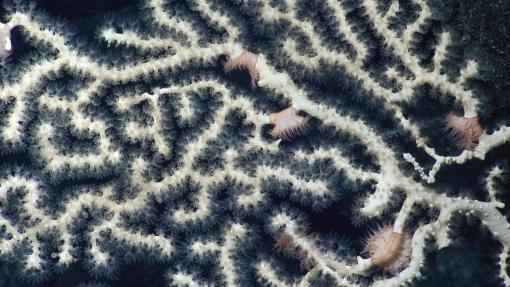
- Coral- how is best to describe a reef-type coral vs a deep water coral? Koʻa (Aia ke koʻa o kahakai ma ke kai pāpaʻu. Aia ke koʻa o ka moana ma ke kai hohonu)
- Sponge - Huʻakai
- Microbes - Mū ʻike ʻole ʻia e ka maka / meaola ʻuʻuku
- DNA - DNA (dēnūʻā)
- Fish - Iʻa
- Seastar - Peʻa
- Crab - Pāpaʻi
- Jellyfish/siphonophore - Pololia
- Anemone - ʻŌkole
Water properties: Nā Hua ‘Ōlelo Pili Wai
- Salinity - Paʻakai
- Temperature - Wela (hot) / Anu (cold)
- Oxygen concentration - ʻOkikene
Learn more about ʻŌlelo Hawaiʻi with these online reference libraries!
Nā Puke Wehewehe ʻŌlelo Hawaiʻi
Created with the support of the Papahānaumokuākea Marine National Monument, the Office of Hawaiian Affairs, NOAA Office of National Marine Sanctuaries, the National Marine Sanctuary Foundation.

Luʻuaeaahikiikalipolipo - Mapping Liliʻuokalani Seamounts in Papahānaumokuākea MNM
This 20-day expedition will involve multibeam and sub-bottom profiler mapping on Liliʻuokalani Seamounts, located in an expansion area of the Papahānaumokuākea Marine National Monument (PMNM). PMNM encompasses 582,578 square miles of the Pacific Ocean, an area larger than all the United States’ national parks combined, and is one of the largest marine conservation areas in the world.

Luʻuaeaahikiikapapakū - Ancient Volcanoes in Papahānaumokuākea Marine National Monument
Returning to Papahānaumokuākea Marine National Monument (PMNM) after an expedition in 2018, our team will be conducting ROV surveys on a chain of seamounts, and document whether these underwater mountains support vibrant coral and sponge communities like others in the region.

Luʻuaeaahikiikekumu - Ancient Seamounts of Liliʻuokalani Ridge
This expedition will have E/V Nautilus returning to Papahānaumokuākea Marine National Monument (PMNM) to build on the accomplishments of the 2021 Luʻuaeaahikiikalipolipo expedition, which mapped the previously unmapped Liliʻuokalani Ridge Seamounts. The team returns for the first visual exploratory surveys of the seamount chain looking to investigate a puzzling split in the seamount trail.

Luʻuaeaahikiikawawāapalaoa: Dual-Technology Seafloor Mapping
This expedition focuses on high-resolution mapping areas of Papahānaumokuākea Marine National Monument (PMNM) currently lacking data using ship-based mapping surveys in deep waters as well as deploying the uncrewed surface vessel DriX for nearshore mapping.

Luʻuaeaahikiikapāpahākuʻiwawā: Seafloor Mapping
This expedition focuses on high-resolution mapping areas of deep waters in the northern extent of Papahānaumokuākea Marine National Monument (PMNM) using ship-based mapping surveys.


